
- Advertising
- Shipbuilding
- Coastal/Inland
- Law & Regulations

AWT Updates Voyage Optimization Software

MarineLink.com June 4, 2013

Applied Weather Technology, Inc. (AWT) announced substantial advancements to its Bon Voyage (BVS) marine voyage optimization system with the release of BVS Version 7.0. The new developments are intended to help ship captains find safer and more fuel-efficient routes. BVS 7 includes access to high-resolution weather and ocean data via broadband, enhanced voyage optimization and new safety features. Haydn Jones, AWT’s Director of International Operations, said, “In the present shipping economic environment of high bunker fuel costs, ship operators and suppliers across the world are looking at a wide range of initiatives to enhance efficiency. Although still valid efficiency solutions, many of these initiatives involve high capital investment or complex installations. Voyage optimization based on present and forecast weather conditions on the other hand is a low investment approach which we believe makes it an essential tool for ship owners and operators alike.” BVS 7.0 comes with enhanced voyage optimization tools. BVS generates highly compressed color-enhanced maps and graphics allowing captains to easily view and interpret potential problem areas. With this data, captains have access to 16-day forecasts updated four times per day and other parameters such as pirate attack information, port vicinity forecasts, satellite imagery and high seas bulletins delivered in near real time. BVS automatically fails over to email data delivery in the event of an Internet interruption so the data never stops flowing to the vessel. BVS 7.0 also has an improved optimization algorithm that includes customizable speed down and consumption curves that deliver more accurate estimates of fuel cost and time en route. The algorithm takes into account ECA areas and the cost differential of fuel types when providing the optimal route, and the route can be customized to use several other criteria including load-line restrictions and user-specified no-go areas. The improved optimization now also displays traffic separation lanes. For planning voyages longer than 10 days, BVS 7.0 includes AWT’s proprietary weather speed loss model called Climatological Ship Resistance. This model uses historical weather from the past 12 years that evaluates the day of the year, vessel location, heading, ship type and the appropriate weather pattern (El Niño, La Niña or Neutral) to calculate the best long range speed loss due to weather. This model gives superior results for short or long term strategic route planning when optimizing a voyage and also when calculating the vessel arrival time. BVS users now have access to port vicinity forecasts for more than 2,700 ports around the world. These forecasts include the air temperature, precipitation amount, visibility, winds and humidity near the port and the winds and waves at the pilot. The forecasts help captains evaluate if conditions on arrival might be a problem and planning weather windows of loading or discharging cargo. BVS includes several safety features such as resonance alerts to inform captains of the potential for severe motions, and advanced environmental modeling that enables AWT to accurately forecast storm strengths and effects. BVS 7.0 also includes an easily accessible forecast indicating where rogue waves are more likely to occur. AWT’s proprietary forecast evaluates the type of rogue waves that are caused by waves opposed by a strong current. With BVS 7.0, AWT adds near real-time access to the global pirate attacks from the IMB that are supplemented with reports from NATO. This information is clearly displayed on a color-coded chart indicating where, when and what type of attack, and a detailed summary can easily be accessed. www.awtworldwide.com
Related News
Merchant vessel reports explosions near yemen.

British security firm Ambrey said early on Friday that a merchant vessel reported two explosions about 21 nautical miles…
Rush to Prevent Oil Spill from Grounded Ship off South African Coast

Salvage operations were in high-gear on Thursday to prevent a potential oil spill and pollution along South Africa's west…
CMA CGM Vessel Drops 44 Containers in Heavy Seas

French shipping and logistics company CMA CGM said on Thursday that its ship "Benjamin Franklin" had lost 44 containers in…
Tanker and Tugboat Crews to Receive IMO Bravery Awards

The 2024 IMO Award for Exceptional Bravery at Sea is to go to two sets of nominees: the captain and crew of the oil tanker…
Sponsored Content
Join military sealift command. this is the right opportunity..

Military Sealift Command is hiring experienced mariners.
A new era for shipping demands a focus on compliance and performance
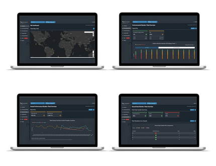
The right software solution can help operators manage the dual demands of regulatory compliance and commercial opportunity
Fuel gas supply systems

Reducing pollutant emissions in the shipping industry with LEWA's diaphragm pumps
Damage Control Officer
Chief radio electronics technician - mixed work schedule, electrician, deck engineer machinist, chief radio electronics technician iat - mixed work schedule.
Emerging Leaders: Max Braddock, Ship Superintendent, Detyens Shipyards
Getting bang for your tech buck.
Subscribe for Maritime Reporter E-News
Maritime Reporter E-News is the maritime industry's largest circulation and most authoritative ENews Service, delivered to your Email five times per week
Bon Voyage System (BVS) for Yachts Launched by AWT
Yachting Journal
Provider of fleet optimization services & onboard voyage management software, Applied Weather Technology, Inc. (AWT), a StormGeo company, says it has launched Bon Voyage System (BVS) for Yachts; an easy-to-use on-board software system for voyage planning that provides up-to-date weather forecasts and ocean data for yacht captains, owners and charterers.
With the launch of this product, AWT, known for its reliable voyage planning products and services in the maritime shipping industry, branches into a new market.
"AWT is well-established in the maritime shipping industry and we are excited to be releasing a customized version of our Bon Voyage System for Yachts," said Haydn Jones, CEO of AWT. "We released the original BVS more than a decade ago for the commercial shipping market and we have continued to refine it within that market. We have tailored this version for the interests of yachts, but it has the same trusted core features of the market leading Bon Voyage System used onboard more than 5000 ships." BVS for Yachts uses high-resolution data, making it easy to plan and optimize routes for time, safety or cost. BVS for Yachts also provides 15-day forecasts and customizable forecast parameters to enable yacht owners to find the best weather window for their departure, and the best route for their voyage. All data is automatically downloaded via the Internet so the latest information is always available. For yachts without Internet access, data is delivered via email. "BVS for Yachts has everything yacht owners need to provide a safe and comfortable voyage for their guests," said Rich Brown, vice president of products and systems at AWT. "Specific areas of ocean forecasts, visibility, port vicinity forecasts and sea surface temperature helps ensure a smooth and enjoyable trip. And with all our products at AWT, we prioritize safety and efficiency. We've included features specifically designed to keep yachts safe while helping them transit as efficiently and comfortably as possible." The software includes safety features such as severe motions or resonance alerts to reduce severe rolling and dangerous vessel motions, detailed rogue wave forecasts, wind speed, sea height, swell height, and global pirate attack information provided by the IMB Piracy Reporting Center. BVS for Yachts also includes AWT's proprietary optimization algorithm to help yacht owners find the most efficient voyage while avoiding adverse weather conditions.
For more information: http://www.awtworldwide.com/products/bon-voyage-yachts.asp
Related News

CHIRP Releases Super Yacht FEEDBACK
Raymarine Launches Performance Sailing Solution

Raymarine’s Axiom Chartplotters Now Integrated with Rhodan’s Trolling Motors

Rolls-Royce Acquires Team Italia


English (USA)
English (UK)
English (Canada)
English (India)
Deutsch (Deutschland)
Deutsch (Österreich)
Deutsch (Schweiz)
Français (France)
Français (Suisse)
Nederlands (Nederland)
Nederlands (België)
- Top Capitalization
- United States
- North America
- Middle East
- Sector Research
- Earnings Calendar
- Equities Analysis
- Most popular
- TESLA, INC.
- PEPSICO, INC.
- AMD (ADVANCED MICRO DEVICES)
- NVIDIA CORPORATION
- AMAZON.COM, INC.
- NIPPON ACTIVE VALUE FUND PLC
- Index Analysis
- Indexes News
- EURO STOXX 50
- Currency Cross Rate
- Currency Converter
- Forex Analysis
- Currencies News
- Precious metals
- Agriculture
- Industrial Metals
- Livestock and Cattle
- CRUDE OIL (WTI)
- CRUDE OIL (BRENT)
- Yield Curve
- Developed Nations
- Emerging Countries
- South America
- Analyst Reco.
- Capital Markets Transactions
- New Contracts
- Profit Warnings
- Appointments
- Press Releases
- Security Transactions
- Earnings reports
- New markets
- New products
- Corporate strategies
- Legal risks
- Share buybacks
- Mergers and acquisitions
- Call Transcripts
- Currency / Forex
- Commodities
- Cryptocurrencies
- Interest Rates
- Asset Management
- Climate and ESG
- Cybersecurity
- Geopolitics
- Central Banks
- Private Equity
- Business Leaders
- All our articles
Most Read News
- All Analysis
- Satirical Cartoon
- Today's Editorial
- Crypto Recap
- Behind the numbers
- All our investments
- Asia, Pacific
- Virtual Portfolios
- USA Portfolio
- European Portfolio
- Asian Portfolio
- My previous session
- My most visited
- Quality stocks at a reasonable price
- Quality stocks
- Trend-Following Stocks
- Growth stocks at reasonable prices
- Millennials
- Warren Buffett
- Unusual volumes
- New Historical Highs
- New Historical Lows
- Top Fundamentals
- Sales growth
- Earnings Growth
- Profitability
- Rankings Valuation
- Enterprise value
- Top Consensus
- Analyst Opinion
- Target price
- Estimates Revisions
- Top ranking ESG
- Environment
- Visibility Ranking
- Stock Screener Home
- Circular economy
- Strategic Metals
- Oversold stocks
- Overbought stocks
- Close to resistance
- Close to support
- Accumulation Phases
- Most volatile stocks
- Top Investor Rating
- Top Trading Rating
- Top Dividends
- Low valuations
- All my stocks
- Stock Screener
- Stock Screener PRO
- Portfolio Creator
- Event Screener
- Dynamic Chart
- Economic Calendar
- Our subscriptions
- Our Stock Picks
- Thematic Investment Lists
- Stock Market News
- StormGeo : Releases BVS 8--Latest Onboard System Advances Safety and Fuel Efficiency
SUNNYVALE, Calif., March 20, 2017 /PRNewswire/ -- StormGeo 's shipping business (formerly AWT) has launched the latest version of its onboard software, Bon Voyage System 8 (BVS 8 ).
StormGeo gathered feedback from existing customers to develop BVS 8(TM) in line with captains' needs. StormGeo's BVS product is used on more than 6000 vessels worldwide. BVS 8 gives clients more tools needed to make the right decisions during a voyage.
"The focus of BVS 8 has been all about improved functionality from a safety and efficiency standpoint, while adding features that make the use of the system easier and more integrated with the bridge," said Michael O'Brien, StormGeo Shipping VP of Product & Business Development. "BVS 8, through the use of the National Marine Electronics Association (NMEA) standard, allows for position input directly into the BVS track from the GPS. This track file can be shared with shore-side interests allowing for near real-time track and position evaluation. This process automates the position input process ensuring the most accurate dead reckoning of the vessel, providing an improved forecast and more accurate ETA."
Position Polling/Track Transfer
When connected to the ship's GPS, BVS 8 conducts position polling at defined intervals. This provides optimal shore-based decision support. The ship's BVS track can be forwarded from the master to their shore-based operations for display in StormGeo's Fleet Decision Support System.
The BVS 8 seakeeping module uses weather forecasts and ship design to predict a vessel's seakeeping characteristics, allowing for more comprehensive route planning and voyage optimization. The motion sensor and the ship specific curves will provide data on vessel dynamics and the sea state. The anemometer integration, through a series of advanced calculations, will determine the wind wave component and swell component of the sea state.
Weather and Ocean Current Based Route Optimization
BVS 8 provides the most recent weather and ocean data to the ship by broadband or email communications in a highly compressed format to minimize communication costs. This data generates color-enhanced maps and graphics that allow the ship's captain to easily view and interpret potential problem areas in advance.
StormGeo's shipping division is dedicated to supporting on-board as well as shore-based operations. StormGeo support does not end when the ship arrives. From port forecasts to logistics line support, StormGeo helps companies understand the impact of weather on their supply chain .
StormGeo's fleet performance solutions apply advanced analytics to its solutions by analyzing hundreds of thousands of voyages to deliver anonymous performance data, moving beyond the traditional KPIs such as fuel optimization, draft and trim optimization.
StormGeo's shipping division is the industry leader routing more than 60,000 voyages per year, helping customers make better decisions and safeguard daily operations.
About StormGeo StormGeo is a global provider of advanced analytics and meteorological services delivering decision support for weather sensitive operations. Since its inception StormGeo has analyzed petabytes of data, transforming it into actionable decision guidance to help customers manage risk and operations, control costs and increase revenue. The company has a leading position in solutions for shipping, offshore oil and gas, renewable energy and corporate enterprise. StormGeo has 23 worldwide offices of which seven are 24/7/365 operation centers. For more information visit www.stormgeo.com or www.bvs8.com .
To view the original version on PR Newswire, visit: http://www.prnewswire.com/news-releases/stormgeo-releases-bvs-8--latest-onboard-system-advances-safety-and-fuel-efficiency-300425729.html
SOURCE StormGeo
All News: More news

Weekly market update: Results season officially kicks-off
Polymarket: A new wave of speculation - Crypto Recap

Swiss authorities draw flak in Credit Suisse probe, report says

Argentina halts monetary base expansion to lower inflation, says minister

South Korea's SK On in talks to supply prismatic EV batteries as it seeks turnaround

US FTC issues warning to franchisors over unfair business practices

Gabelli asks Paramount for details on National Amusements valuation

Auto workers union chief blasts Trump, praises Biden without using his name

Wall Street: steady rebound (+0.6%) despite disappointing PPI figures

First Republic ex-employees' lawsuit against US FDIC is dismissed

Investors react to shooting at Trump election rally
Trump-victory trades to swell after shooting, investors say

FBI identifies Thomas Matthew Crooks as 'subject involved' in Trump rally shooting

Elon Musk says he fully endorses "tough" Trump, posts photo

Italian sports journalist is falsely identified as Trump shooter on social media

Possible security lapses in focus after Trump rally shooting

Pop, pop, pop, then a bloodied Trump rushed from election rally

Kuwait says government spending must be fixed to control budget growth

Goldman challenges Fed's demand it hold more capital after stress test, FT reports

Russia accuses Biden administration of creating atmosphere for attack on Trump

- Stock Market

- Loss Prevention
- Maritime Health

Dozens of containers lost overboard due to adverse weather

Severe weather halts Cape of Good Hope container traffic

Lessons learned: Collision between a bulk carrier and a fishing vessel in the Yellow Sea

EMSA: Safety considerations for hydrogen-fuelled ships
- Intellectual

Unlocking inner growth: The transformative benefits of journaling
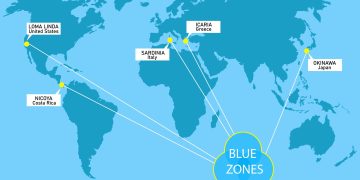
Want to live a long life? Learn how from the word’s Blue Zones

How to tell if you’re dehydrated onboard: Signs and symptoms

Stay SEAFiT: How to combat harassment and bullying on board
- Green Shipping
- Ship Recycling

INTERTANKO calls MEPC 82 for improved CII application for tankers

Joint effort to evaluate onboard hydrogen production and utilization

Ballast Water Record Book: Entry requirements

OPEC sticks to prediction of 2.25 million barrels per day
- Connectivity
- Cyber Security
- E-navigation
- Energy Efficiency
- Maritime Software

ECSA and ETF unite to support seafarers’ digital transition

ZeroNorth launches eBDN with Vitol Bunkers in Singapore

Iraq moves on with maritime single window implementation

The Nautical Institute Annual Conference 2024: Charting a greener world

Watch: West Club explains what to expect during PSC inspections

BMA: New Concentrated Inspection Campaign on bulk carriers registered in the Bahamas starts in August

AMSA announces new focus on PSC compliance

ClassNK Annual PSC Report: Fire remains the most common deficiency area
- Diversity in shipping
- Maritime Knowledge
- Sustainability

Asian port congestion escalates due to Red Sea diversions

Saltchuk acquires Overseas Shipholding
Texas struggles with aftermath of Hurricane Beryl

REDO initiative: Psychological safety is the foundation of a healthy work environment

NorthStandard Club: Data dialogue vital for Maritime Energy Transition


Decarbonizing shipping industry: A health and safety-first approach
Trending tags.
- Book Review
- Career Paths
- Human Performance
- Industry Voices
- Maritime History
- Regulatory Update
- Seafarers Stories
- Training & Development
- Wellness Corner
- Wellness Tips

New onboard system launched to improve safe navigation

Credit: StormGeo
StormGeo, provider of meteorological services, has launched the latest version of its onboard software, Bon Voyage System 8 (BVS 8). The company gathered feedback from current users to develop the system in line with captains’ needs, helping them to make the right decisions during a voyage.
“The focus of BVS 8 has been all about improved functionality from a safety and efficiency standpoint, while adding features that make the use of the system easier and more integrated with the bridge,” said Michael O’Brien, StormGeo Shipping VP of Product & Business Development. “BVS 8, through the use of the National Marine Electronics Association (NMEA) standard, allows for position input directly into the BVS track from the GPS. This track file can be shared with shore-side interests allowing for near real-time track and position evaluation. This process automates the position input process ensuring the most accurate dead reckoning of the vessel, providing an improved forecast and more accurate ETA.”
When connected to the ship’s GPS, BVS 8 conducts position polling at defined intervals. This provides optimal shore-based decision support. The ship’s BVS track can be forwarded from the master to their shore-based operations for display in StormGeo’s Fleet Decision Support System.
The company notes that the system’s seakeeping module uses weather forecasts and ship design to predict a vessel’s seakeeping characteristics, allowing for more comprehensive route planning and voyage optimization. The motion sensor and the ship specific curves will provide data on vessel dynamics and the sea state. The anemometer integration, through a series of advanced calculations, will determine the wind wave component and swell component of the sea state.
In addition, BVS 8 provides recent weather and ocean data to the ship by broadband or email communications in a highly compressed format to minimize communication costs. This data generates color-enhanced maps and graphics that allow the ship’s captain to easily view and interpret potential problem areas in advance.
Related News
Advancing maritime safety with innovative ship trajectory prediction tool, chirp: create a culture of incident sharing in maritime to reduce safety risks.
Source & Image credit: StormGeo

Industry calls for action to prevent decline in UK shipping
Fuel storage terminal to be constructed at port of rotterdam.

Why soft skills are important for effective crew management
NAPA enhances wind propulsion efficiency for IINO Lines’ green fleet

Sea-Intelligence: Shipping schedule improvements amid Red Sea crisis aftermath
Weather routing for wind propulsion vessels: Key ingredient for decarbonization

Veson Nautical: As the industry looks ahead, we need data in context to augment human decision-making

Good communication is key to solving difficult issues
Leave a reply cancel reply.
Your email address will not be published. Required fields are marked *

Explore more

- SAFETY4SEA Events
- SAFETY4SEA Plus Subscription
Useful Links
- Editorial Policies
- Advertising
- Content Marketing
© 2021 SAFETY4SEA
- PSC Case Studies
- Tip of the day
- Training & Development

- Webinars ~
- Athens ~ 10 Oct. 2024
- Bergen ~ 20 Nov. 2024
- Future Events
- Past Events~
BVS integrated with e-Navigator
- Friday, 06 December 2013 | Software, Big Data & IoT
Applied Weather Technology (AWT) has announced that its Bon Voyage System (BVS) has been integrated with UKHO’s ADMIRALTY e-Navigator system, with the aim of allowing for simplified passage planning in the software.
“The seamless integration of the track transfer between BVS and e-Navigator will help captains find the most efficient route while making the passage planning process easier and less time consuming,” said AWT’s CEO Haydn Jones.
Users can employ the BVS system to find the most efficient route, based on weather constraints, then display the track in e-Navigator to validate that a vessel has all the required charts. The track can then be passed to the onboard ECDIS system to confirm that it is navigationally safe.
Nick Hyam, senior product manager for ADMIRALTY e-Navigator, said: “The UKHO is pleased to be working with AWT, the acknowledged leader in voyage management software, to provide the navigator with a seamless voyage planning and route optimisation solution which delivers real benefits in terms of cost and time saving.”
ADMIRALTY e-Navigator is an application that organises, updates, and brings together all of the paper and digital information needed to plan ship voyages.
AWT’s Bon Voyage System (BVS) is an icon-driven graphical marine voyage optimisation system that provides weather-routing and other voyage related information.
- Applied Weather Technology (AWT)
- United Kingdom Hydrographic Office (UKHO)
- Voyage and Trim optimisation
- Voyage Planning
Related items
ChartWorld has launched its updated MyRA 1.8 automatic voyage planning tool. This version includes key user experience improvements, including the ability to avoid or minimize navigating in pre-defined areas. Other features include expanded ECDIS compatibility and the further development of automatic route creation capabilities to match specific user needs.
The onboard MyRA 1.8 application is further integrated into the shoreside ‘MyFleet’ web application. MyRA can now accept voyage orders created in MyFleet and automatically convert them to a voyage plan request that can be adjusted by the crew to reflect existing onboard vessel and voyage conditions.
The new Route Network functionality incorporated into the MyRA application provides an improved preview of the route request before it is sent for the shore-based automatic voyage plan calculation. Key features include:
- For cases where the voyage is calculated to start or end outside of a port, the user can now define and visualize the route starting or ending from any position.
- Users can now include intermediate points for the voyage, defining specific locations where the route must pass.
- The onboard Route Network has been significantly reduced in size, enabling automatic remote updates to be performed through the MyRA Information Service.
- MyRA now enables users to define whether the route should avoid or minimize navigating in a specific area such as Internal waters (the baseline), Territorial waters, or ECA.
In an expansion in system compatibility, users of MyRA 1.8 who use ECDIS models that do not support the RTZ route format can get the MyRA route exported to the specific ECDIS format without the need for an external route converter. MyRA now can export and import routes into many ECDIS formats by using the built-in route converter.
Additional functions include the ability to define the cargo that should be considered in the automatic route calculations in the ChartWorld Route Network.
Blue Water has launched the BOSS mobile app for iOS and Android smartphones, for voyage planning and operations. The BOSS mobile app provides real-time vessel monitoring, instant notifications, and access to up-to-date information.
Yara Marine Technologies has launched Route Pilot AI, a cloud-based artificially intelligent (AI)-powered ship operation support system that utilises high-frequency data to calculate the most advantageous propulsion settings for upcoming voyages.
Augmented Routing Optimisation which integrates weather routing into AI-based voyage analytics is changing what is possible in ship performance, according to METIS Cyberspace Technology.
NAVTOR has added a new advanced auto-routing module to its NavStation digital chart table.
Login/Register
Register or Login to view even more of our content. Basic registration is free.
- Create an account
- Forgot your username?
- Forgot your password?
Register now
News archive
- July 2024 (12)
- June 2024 (54)
- May 2024 (40)
- April 2024 (35)
- March 2024 (32)
- February 2024 (29)
- January 2024 (50)
- December 2023 (32)
- November 2023 (53)
- October 2023 (51)
- September 2023 (59)
- August 2023 (34)
Digital Ship magazine provides the latest information about maritime satellite communications technology, software systems, navigation technology, computer networks, data management and TMSA. It is published ten times a year.
- Download Magazine
- Vessel Performance
Address: Digital Ship Ltd Digital Ship - Digital Energy Journal 39-41 North Road London N7 9DP United Kingdom
Copyright © 2024 Digital Ship Ltd. All rights reserved Cookie Policy Privacy Policy
- Digital Archives
- Order a Copy

Unicom using Applied Weather’s BonVoyage marine software
After first adopting BVS in 1999 as part of a trial on three ships, SCF Unicom observed that the onboard software was helping its Captains to reduce heavy weather damage to those ships. The company then quickly expanded use of BVS to approximately 17 ships within its managed fleet, and after positive feedback from Captains, now routinely deploys BVS to all new vessels. BVS is now deployed on more than 70 Unicom vessels.
According to SCF Unicom, BVS helps the company reduce costs and delays spent in dry dock for repairs from heavy weather damage. BVS also saves the company money by preventing the occurrence of heavy weather vessel damage, which has in the past cost around $100,000 per incident and taken ships out of commission, causing them to lose valuable time at sea and revenue. Since 2001 Unicom has not suffered any serious structural damages due to heavy weather encounters. Damages have been mostly limited to minor fittings and fixtures.
“We used to measure heavy weather damage in terms of hundreds of thousands of dollars and the number of days our ships spent being repaired – now we measure our heavy weather damage in the tens of dollars and number of lost lifebuoys,†said David Sharp, HSSE (health, safety, security and environmental) Team Manager at Unicom. “We have trialed other companies’ weather data, and my opinion the onboard software we have from AWT is the most visually easy to understand and follow. Our crews are very comfortable using it to avoid conditions that could cause heavy weather damage.â€
“We would like to recognize SCF Unicom for demonstrating that the company is innovative and forward-thinking by adopting AWT’s onboard routing software 10 years ago when these systems were still somewhat in their infancy, and for continuing to leverage the latest BVS technology to the full benefit of its Captains, crews and fleet today,†said Skip Vaccarello, president and CEO of AWT. “Currently over 99% of BVS users continue to operate and upgrade the software, and we are very pleased that Unicom remains a longstanding customer.â€
SCF Unicom says that in addition to using BVS to avoid dangerous weather conditions, its ship Captains also use BVS to examine ways to minimize fuel consumption and therefore carbon emissions, and to select the most time- and fuel-efficient routes to their destinations. Also, when there are weather systems that cause concern for their Captains and operations teams, they take advantage of AWT’s weather routing services to ensure crew, vessel and cargo safety.
More than 3000 vessels from numerous companies use BVS to help identify the safest, most time-efficient or fuel-efficient routes. BVS is an icon-driven graphical marine voyage optimization system that provides ship Captains with onboard and around-the-clock weather-routing information. One of the key differentiators between BVS and competing solutions is that BVS not only delivers weather forecasts, but also creates custom and optimal routes for ship Captains based on data from weather as well as waves, currents, cargo and vessel specifications.
AWT recently announced the latest update to BVS, Version 5.6, which now provides Captains with advance warning about threats of severe motions due to resonance, and integrates the latest technology used to determine ocean currents by offering forecast, real time Naval Coastal Ocean Model (NCOM) current data. For more information about BVS, please visit http://www.awtworldwide.com/products/bon-voyage-system.asp.
AWT (www.awtworldwide.com) is the leading provider of fleet optimization services and onboard voyage management software to ship owners, operators and charterers seeking the safest and most efficient routes for their fleets. Unlike companies that provide weather services for multiple industries, or companies which only offer onboard weather software, AWT is staffed by world-renowned experts in ship routing, meteorology, IT, maritime science and former ship captains who are focused solely on the maritime industry. Using the most sophisticated technology available, AWT routes more ships per month than any other company. Its superior customer service and integrity have made AWT the most trusted fleet optimization provider in the maritime industry. Founded in 1996, AWT is privately held and headquartered in Sunnyvale, California with worldwide offices located in the UK, Hong Kong, Shanghai, Korea, Germany, New York, and New Jersey. More information is available at www.awtworldwide.com or by calling 1-408-731-8600.
About SCF Unicom Unicom Management Services (Cyprus) Ltd is the wholly owned ship manager for the Russian State ship owning company JSC Sovcomflot. JSC Sovcomflot has two other ship management teams – SCF Novoship in Novorossiysk and SCF Marpetrol in Spain. SCF Unicom headquarters was established in Limassol, Cyprus in January, 1991 as a joint venture between the Swiss based ship management company, Acomarit and Russia’s state owned shipping company, Sovcomflot. In 1994 Sovcomflot purchased Acomarit’s 70% stakehold in Unicom and nominated Unicom as its exclusive manager for the Sovcomflot fleet. Since that time Unicom has steadily grown into one of the most reputable ship management companies within the sector. Its managed fleet currently comprises over 79 vessels and has expanded to include crude oil and gas tankers and most recently, ice class tankers for employment in Russia’s Arctic region. More information can be found at http://www.unicom-cy.com.
All trademarks are the property of their respective owners.
By Professional Mariner Staff
What Weather Models do Phone Apps Use? Why use Programs like Bon Voyage?
??? Windy’s own website says Windy uses NOAA models. So why are you asking me these questions?
Why don’t you contact Windy and argue with them to stop using the NOAA models they so prominently mention on their website?
So you think everyone started using Windy for the pretty colors, or because we’re dagnabbit millennials who want another excuse to stare at a smartphone?
Can I ask why you pay for Bon Voyage then? The NOAA forecast is available for free. Is it for the cool name?
According to the Windy website:
On Windy we use models GSF with 22km resolution grid, ECMWF with 9km resolution grid and a lot of local models with resolution even 3km.
GSF being the model used by the NWS.
The reason for using Bon Voyage and similar services is analogous to the reason we use GPS maps in the car instead of transferring the position to a paper map. Saves the time and effort of the additional step of constant updates to position.
With the weather the map also changes every 6 hours with each update.
Windy offers multiple models that you can select from, some models being more accurate for certain weather systems and locations than others. This is where the greater accuracy comes in. When they say that on their website they are just referring to the default model displayed.
Bon Voyage and most other modern weather tools offer the same functionality. If you’re only using them to display your position on a weather map you’re not using them correctly.
Context is everything: This thread started because on another thread, posters (not you) were alleging that weather data and weather predicting models from NOAA and NASA were worthless, because of politics and conspiracy theories. I argued this was incorrect.
You narrowly stated that:
I pointed out your statement is factually incorrect, because Windy has on its app NOAA models. Windy would not use them if they thought they were functionally inaccurate.
Perhaps what you meant to say is that totality of users of the Windy app never look at the NOAA models. But that’s just an opinion of yours. My captains look at all the data they can get. They use BVS and they use Windy. They look at this model and that model. I think most mariners would do the same in the volatile GOA and Bering Sea. To prove your point you would have to convince me that mariners do not refer to NOAA models and NASA data. Since I know that to be otherwise, I’m not convinced.
You then make a statement which I completely agree with:
That statement is perfectly reasonable. It is nuanced. It allows for the reality that different nations will focus their weather prediction efforts on their own parts of the world, and on certain regions. But to categorically state that no one uses NOAA models or NASA data is absolutist, and like most absolutist statements outside of physics and mathematics, factually incorrect.
I think you are conflating exclusive use of the NWS website as compared to using Windy, or BVS, and saying no one uses NWS exclusively. I never argued they did. All along I have simply argued this: Mariners rely on NOAA models and NASA data every day, to keep alive. And if you think I’m wrong, consider this: if a NOAA weather model showed your boat in imminent danger from a typhoon, and another model said probably not, would you keep on your present course?
Windy is BS ,do they launch their own satellites? When these third party weather prognosticators decide to invest in their own satellites and the means to get them into orbit I will reconsider my opinion of them. I currently consider them scam artists who use the taxpayer funded resources to try and enrich themselves.
I look at the NOAA forecast every update, in fact I just did. Primarily because I’ve seen over reliance on Windy get captains in trouble with sea heights.
You used the NOAA weather forecast as an example. That was a poor example. I provided a very obvious everyday example of why.
To go along with your example, say NOAA is forecasting 60 knots and windy only 45 at a wind direction I can haul with the way my gear is currently set. I will go with the Windy model because it has proven more accurate in the past. If I continually shifted gear to account for severe weather forecasts that didn’t materialize I wouldn’t get much done.
Similarly, if we as a society use our limited resources to combat carbon instead of microplastics we run the risk of shifting our gear for a storm that may not materialize while we end up getting walloped by another.
Are you familiar with programs like Bon Voyage? We used a program from AWT which is now the same company. It’s not just another weather tool it’s a ship routing program.
The key feature is that the ship’s position can be seen in relationship to the various (electronic) weather maps. The ship’s speed of advance is modeled given wind, sea and current and the current position is projected (in 6 hour increments) along the future track.
The last I used it there was no feature that allowed using different models. AWT also send port forecast separately but we also received and used the text weather from the Sat-C and maps from the Fax (later downloaded from the internet).
The routing software is a powerful tool but the text forecast are crucial because of the 6 hour or so delay between when the routers receive the forecasts and when that update arrives on the ship.
Most modern chart plotter software offers the same functionality of routing and at any rate that’s fairly easy to do with Windy. Automated ship routing for weather and it’s accuracy is probably a subject for a different thread. It would be unusual to see a weather program nowadays that didn’t offer at least ECMWF, GFS, NAM and ICON.
You have to put some work in at home going through the archive sites and seeing how each weather system developed vs. the forecast for the time of year, water temps, pressures etc. As with all nautical decisions there is a certain amount of intuition involved and sometimes that is wrong.
If you have a 6 hour delay nowadays something is wrong. I still plot weather systems on occasion to keep in practice but the reality is if something bad enough happens to stop the internet data the fax probably isn’t coming either.
There is delay of several hours, nothing to do with me. Using Alt-F for “BVS” on this document will give a good idea: https://www.ntsb.gov/investigations/AccidentReports/Reports/MAR1701.pdf .
The Windy app could have a lot of value in some situations but ultimately I used the forecasts from the various weather services depending on our location. Can’t do ensemble forecasting / Monte Carlo simulations etc aboard the ship. Also the Windy app doesn’t show the weather fronts.
My formal training in weather routing comes from having taking a class at the union school from the person who wrote this article: Mariner’s Guide to the 500 – Millibar Chart here - : Mariners Weather Log Vol. 52, No. 3, December 2008
I find the article tough sledding but it’s a good reminder of how much skill and knowledge a professional meteorologist brings to the table.
I also took a copy of this book to sea with me: https://www.amazon.com/Heavy-Weather-Avoidance-Route-Design/dp/0939837781
Joe is a classmate from Ft. Schuyler ('80), he used his meteorology degree, I didn’t. He now telecommutes fill time from your vicinity (Camden)
The one that was an instructor was Chesneau. Five day course, very good.
Sienkiewicz does have an impressive resume
. “After graduation I worked for five years as mate and captain on tugboats based out of New York”.
Windy uses ECMWF, GFS, NEMS, ICON-EU, AROME and NAM.
BVS was at the origin of the ‘El Faro’ disaster. Not the program itself, it is what it is, but the exclusive use of it, discarding all other info arrived on the bridge, especially the Navtex/Sat-C weather.
The afternoon before the sinking, the crew knew perfectly that they were on a collision course with the hurricane’s center, but BVS did not…
There are no ‘models’ needed to preview the path of a highly volatile hurricane for the next six hours. Today, all real weather data is available in quasi real-time, models could only distort the obvious finding that the hurricane goes South… as did BVS. AS for the longer term models, only ECMWF had ‘Joaquin’ right over days…
BVS and other similar programs are very useful for weather routing over a periods out several days for ocean transits and the like.
For shorter time / distance over the next day or two the SAT-C text / wx fax (or via email etc) are most useful.
For the next 24 hr or so the current weathe observations become more important.
All three together for the full picture.
Here’s a screen shot of AWT Savanah to Straits of Gibraltar

Since you keep referring to it as ‘the Windy app’ and you put ‘phone apps’ in the thread title, you may want to visit the Windy website and spend some time on the Windy community pages if you want to understand the capabilities of the tool for mariners.
There’s certainly enough information to draw your own front lines, although I’m not sure why you would. Using 1930s techniques with modern information availability doesn’t make a lot of sense.
A lot of seafarers look at passage weather:
https://www.passageweather.com/
Predictwind is another good tool that is often more accurate North of St. Matthew
For a deep-sea ship that’s like asking why would anyone would call a vessel on VHF Ch-16. Both VHF and Sat-C are part of the required GMDSS equipment on the bridge where there is a licensed operator on watch anytime while underway.
Yes, Windy.com is great tool and I’ve been using it since I learned about it on this site. Nothing wrong with using it but it’s not a substitute for the GMDSS equipment for several reasons.
EDIT: The shipboard GMDSS equipment is just the ship side of the SAFEYNET system.
I’m not sure what you’re referring to. I was referring to drawing front lines, as you said Windy doesn’t display them.
Related Topics
Does Revenue Optimization make a difference?
Multi-dimensional profile analysis, flat data analysis, intelligent pricing strategy, inconsistent pricing strategy, optimum visibility, ineffective visibility, extensive market insights, access to limited data set, we have brought you certified revenue experts.

Outsourcing or purchasing a dedicated revenue management solution costs you a fraction of that, in addition to a bundle of more benefits.
We MINT magic by optimizing revenue
Thank you, ycs.
The fact that YCS has been in the industry for 15 years, only adds to its expertise and my faith in them. The team works amazingly.
The fact that YCS has been in the industry for 15 years, only adds to its expertise and my faith in them. The team and the revenue management software works amazingly.
The best services I have come across
YCS has done it yet again. I have tried and tested many, many revenue management services in the market, and YCS has by far stood by what they promised.
Better than others
I would definitely recommend YCS’s revenue management services to everyone. The team knows what they are doing and are very clear about meeting our requirements. They have done magic with our property. Very very happy!
Is your property earning revenue to its maximum potential?
Majority of hotels don’t focus on optimizing their revenue; either because they lack expertise or resources. Use our calculator to know how much you are missing out on by not opting for a hotel revenue management solution.
Trusted by the world’s most successful properties since 2006
You invest x, we earn you 2x.
We’re fighting to restore access to 500,000+ books in court this week. Join us!
Internet Archive Audio

- This Just In
- Grateful Dead
- Old Time Radio
- 78 RPMs and Cylinder Recordings
- Audio Books & Poetry
- Computers, Technology and Science
- Music, Arts & Culture
- News & Public Affairs
- Spirituality & Religion
- Radio News Archive

- Flickr Commons
- Occupy Wall Street Flickr
- NASA Images
- Solar System Collection
- Ames Research Center

- All Software
- Old School Emulation
- MS-DOS Games
- Historical Software
- Classic PC Games
- Software Library
- Kodi Archive and Support File
- Vintage Software
- CD-ROM Software
- CD-ROM Software Library
- Software Sites
- Tucows Software Library
- Shareware CD-ROMs
- Software Capsules Compilation
- CD-ROM Images
- ZX Spectrum
- DOOM Level CD

- Smithsonian Libraries
- FEDLINK (US)
- Lincoln Collection
- American Libraries
- Canadian Libraries
- Universal Library
- Project Gutenberg
- Children's Library
- Biodiversity Heritage Library
- Books by Language
- Additional Collections

- Prelinger Archives
- Democracy Now!
- Occupy Wall Street
- TV NSA Clip Library
- Animation & Cartoons
- Arts & Music
- Computers & Technology
- Cultural & Academic Films
- Ephemeral Films
- Sports Videos
- Videogame Videos
- Youth Media
Search the history of over 866 billion web pages on the Internet.
Mobile Apps
- Wayback Machine (iOS)
- Wayback Machine (Android)
Browser Extensions
Archive-it subscription.
- Explore the Collections
- Build Collections
Save Page Now
Capture a web page as it appears now for use as a trusted citation in the future.
Please enter a valid web address
- Donate Donate icon An illustration of a heart shape
Bon voyage!
Bookreader item preview, share or embed this item, flag this item for.
- Graphic Violence
- Explicit Sexual Content
- Hate Speech
- Misinformation/Disinformation
- Marketing/Phishing/Advertising
- Misleading/Inaccurate/Missing Metadata
![[WorldCat (this item)] [WorldCat (this item)]](https://archive.org/images/worldcat-small.png)
plus-circle Add Review comment Reviews
114 Previews
10 Favorites
Better World Books
DOWNLOAD OPTIONS
No suitable files to display here.
EPUB and PDF access not available for this item.
IN COLLECTIONS
Uploaded by station39.cebu on October 1, 2020
SIMILAR ITEMS (based on metadata)

- - Ubuntu servers
- - Debian servers
- - Fedora servers
- - Special Servers
- - Programs to run
- - GDrive open session
- - GDrive save session
- - Our Web Extensions
- - Our IOS apps
- - Our Android apps
- - Download Linux apps
- - Download Windows apps
- - AntiVirus online
- - VPN secure proxy
- - File sharing
- - Run OnWorks free
- - Run OnWorks without ads

- Skip to content
Ubuntu | Fedora | VPN | File sharing
Bon Voyage download for Windows
This is the Windows app named Bon Voyage whose latest release can be downloaded as cmsimplerss_r46.zip. It can be run online in the free hosting provider OnWorks for workstations.
Download and run online this app named Bon Voyage with OnWorks for free.
Follow these instructions in order to run this app:
- 1. Downloaded this application in your PC.
- 2. Enter in our file manager https://www.onworks.net/myfiles.php?username=XXXXX with the username that you want.
- 3. Upload this application in such filemanager.
- 4. Start any OS OnWorks online emulator from this website, but better Windows online emulator.
- 5. From the OnWorks Windows OS you have just started, goto our file manager https://www.onworks.net/myfiles.php?username=XXXXX with the username that you want.
- 6. Download the application and install it.
- 7. Download Wine from your Linux distributions software repositories. Once installed, you can then double-click the app to run them with Wine. You can also try PlayOnLinux, a fancy interface over Wine that will help you install popular Windows programs and games.
Wine is a way to run Windows software on Linux, but with no Windows required. Wine is an open-source Windows compatibility layer that can run Windows programs directly on any Linux desktop. Essentially, Wine is trying to re-implement enough of Windows from scratch so that it can run all those Windows applications without actually needing Windows.
DESCRIPTION
User interface, programming language.
This is an application that can also be fetched from https://sourceforge.net/projects/bonvoy/. It has been hosted in OnWorks in order to be run online in an easiest way from one of our free Operative Systems.
Free Servers & Workstations
Download Windows & Linux apps
- Windows apps
Linux commands

Copyright ©2023 OffiDocs Group OU. All Rights Reserved. OnWorks® is a registered trademark.
- Cookies Policy
- Cloud Apps Policy
- Mobile Apps Policy
- Terms of Service
- Support & Contact

IMAGES
COMMENTS
Ship-to-shore route and data exchange. Combined with StormGeo's s-Insight, BVS sets up a valuable communication protocol between a vessel and the shore-based manager, allowing for the display of the current route track as well as the route planned in BVS. Routes and position reports are displayed in our shore-based s-Insight.
We deliver the intel to bring you from shore to shore with safety. We are the industry leader in weather intelligence and ship routing services. More than 12,000 ships rely on our software and services for navigational planning, route optimization, weather and fleet performance. With 26 offices worldwide, including ten 24/7/365 global ...
Module 1: Getting to know BVS 8. Introduction to BVS 8. BVS 8 features and improvements. Initial program setup. Chart projection and manipulation. Weather icons and menu features. Menu functions: File, Edit, View, Data. Menu functions: Setup, Help. Horizontal and vertical panels.
Technology, Data, and Human-Expertise 24/7/365. We prioritize technological innovation, rigorous validation, and accurate analysis. Our team includes industry experts, experienced analysts, developers and engineers who provide timely, challenge-specific solutions, and are available 24/7/365 days a year. See how we helped hospitals save lives.
Applied Weather Technology, Inc. (AWT) announced substantial advancements to its Bon Voyage (BVS) marine voyage optimization system with the release of BVS Version 7.0. The new developments are ...
BVSTM 7. ystemAWT's Bon Voyage System (BVS) is a graphical marine voyage optimization system that provides on-board and around-the-clock weather-routing inform. tion. This sophisticated yet user-friendly system is both comprehensive and cost effective, making it an indispensable route planning. tool.Voyage Optimization - Calculate Least Time ...
"Welcome to the world of maritime efficiency and safety with the Bon Voyage System (BVS). In this introductory video, we dive into the essential features and...
SUNNYVALE, Calif., March 20, 2017 /PRNewswire/ -- StormGeo 's shipping business (formerly AWT) has launched the latest version of its onboard software, Bon Voyage System 8 (BVS 8 ). StormGeo ...
Applied Weather Technology (AWT) has released a new version of its Bon Voyage (BVS) marine voyage optimisation system, BVS Version 7.0, featuring a number of new developments intended to help vessels find safer and more fuel-efficient routes. The company says that BVS 7 includes access to high-resolution weather and ocean data via broadband ...
Provider of fleet optimization services & onboard voyage management software, Applied Weather Technology, Inc. (AWT), a StormGeo company, says it has launched Bon Voyage System (BVS) for Yachts; an easy-to-use on-board software system for voyage planning that provides up-to-date weather forecasts and ocean data for yacht captains, owners and charterers.
SUNNYVALE, Calif., March 20, 2017 /PRNewswire/ -- StormGeo 's shipping business (formerly AWT) has launched the latest version of its onboard software, Bon Voyage System 8 (BVS 8). StormGeo gathered feedback from existing customers to develop BVS 8(TM) in line with captains' needs. StormGeo's BVS product is used on more than 6000 vessels worldwide.
"🌊 Welcome aboard our maritime hub! ⚓ Explore the world of seamless navigation and enhanced safety with Bon voyage, your go-to destination for all things Bon Voyage System. 🚢 Dive into our ...
StormGeo, provider of meteorological services, has launched the latest version of its onboard software, Bon Voyage System 8 (BVS 8). The company gathered feedback from current users to develop the system in line with captains' needs, helping them to make the right decisions during a voyage.
Applied Weather Technology (AWT) has announced that its Bon Voyage System (BVS) has been integrated with UKHO's ADMIRALTY e-Navigator system, with the aim of allowing for simplified passage planning in the software. "The seamless integration of the track transfer between BVS and e-Navigator will help captains find the most efficient route ...
BVS 8 gives clients more tools needed to make the right decisions during a voyage. "The focus of BVS 8 has been all about improved functionality from a safety and efficiency standpoint, while adding features that make the use of the system easier and more integrated with the bridge," said Michael O'Brien, StormGeo Shipping VP of Product ...
(SUNNYVALE, Calif.) — Applied Weather Technology, Inc. (AWT) today announced that Unicom Management Services (Cyprus) Ltd has now been using its BonVoyage software (BVS), the world’s most popular onboard system for optimizing marine voyages, for 10 years to help its ship Captains steer clear of heavy weather in order to avoid vessel damage and prevent crew injury.
Bon Voyage and most other modern weather tools offer the same functionality. If you're only using them to display your position on a weather map you're not using them correctly. ... The routing software is a powerful tool but the text forecast are crucial because of the 6 hour or so delay between when the routers receive the forecasts and ...
BTS bon voyage season 1-4. Skip to main content. We're fighting to restore access to 500,000+ books in court this week. Join us! ... Software. An illustration of two photographs. Images. An illustration of a heart shape Donate. An illustration of text ellipses. More An icon used to represent a menu that can be toggled by interacting with this ...
Software. An illustration of two photographs. Images. An illustration of a heart shape Donate. An illustration of text ellipses. More. An icon used to represent a menu that can be toggled by interacting with this icon. Internet Archive Audio. Live Music ... Bon voyage! Teacher's Tools
The team and the revenue management software works amazingly. Gordon Smith Bon Voyage Hospitality. The best services I have come across. YCS has done it yet again. I have tried and tested many, many revenue management services in the market, and YCS has by far stood by what they promised.
Internet Archive. Language. French. 5 volumes : 29 cm +. Bon voyage is a comprehensive program that encourages meaningful, practical communication by immersing your students in the language and culture of the Francophone world. The text and its complementary resources help you meet the needs of every student in your diverse classroom.
Bon Voyage free download Windows app and run it online in OnWorks over OS online like Ubuntu, Fedora, Debian, Kali OS wine. Products o - Ubuntu servers - Debian servers - Fedora servers - Special Servers ... Wine is a way to run Windows software on Linux, but with no Windows required. Wine is an open-source Windows compatibility layer that can ...